2D SPAN
Since its inception, this program spread over several phases and data additions across the basin and includes streamer, land, transition zone, and OBC data.
GulfSPAN was planned with the specific goal of better understanding regional geology and the deeper, less explored areas of the Gulf Coast. Particular attention was paid to positioning each 2D seismic data acquisition survey line to allow ties to key developments, traverse key depositions and structural provinces, and image deep structure stratigraphy. The entire dataset was recently reprocessed using Reverse Time Migration (RTM) and includes a complete rebuilding of the velocity models and interpretation.
A critical addition to the GulfSPAN program was the grid of composite strike and dip lines using carefully selected legacy data, including 2D seismic data, from Seismic Exchange, Inc. (SEI) and Geophysical Pursuit, Inc. (GPI). This regional onshore addition crosses five states with a consistent, depth-imaged dataset to tie onshore fields to offshore regions, map key shelf edges, and show the structural setting of the onshore basins.
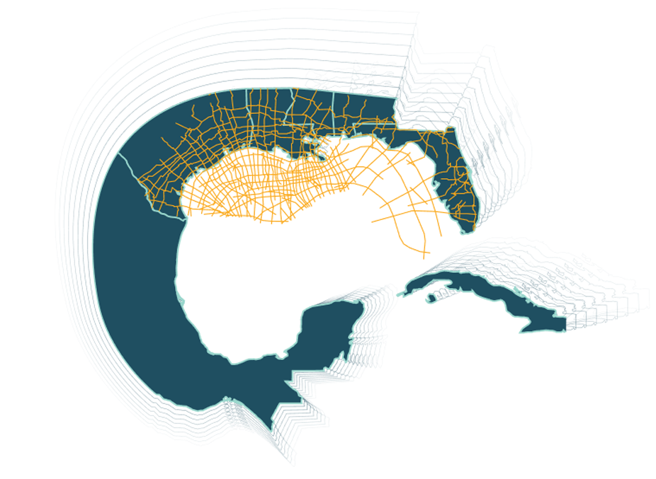
FloridaSPAN
FloridaSPAN includes offshore data and an onshore grid of reprocessed legacy data from Seismic Exchange, Inc. (SEI) and Geophysical Pursuit, Inc. (GPI). The offshore 2D seismic data covers the shelf margin and deep water in the eastern Gulf of America while the onshore grid transects four states to reach the east coast. These lines connect to the GulfSPAN onshore and offshore grid. FloridaSPAN covers an important part of the history of the Gulf of America rifting events.
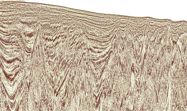
The offshore data includes 2D seismic data acquired in the eastern Gulf and depth imaged to 40km with both Kirchhoff and Reverse Time Migration (RTM) to integrate gravity, magnetic, and well data. They are positioned to cross the Florida shelf and escarpment and extend into deep water with special emphasis on crossing the continental to oceanic crustal boundary, tying important wells, and transecting Jurassic basins and highs. The deep imaging on this dataset reveals more criteria to assist models of crustal structure and show the nature of the boundary between continental and oceanic crust as a crustal boundary detachment feature.