Doubling Down in the Appalachian: Fairfield’s Seismic Expansion Powers Smarter Investment
Key Takeaways:
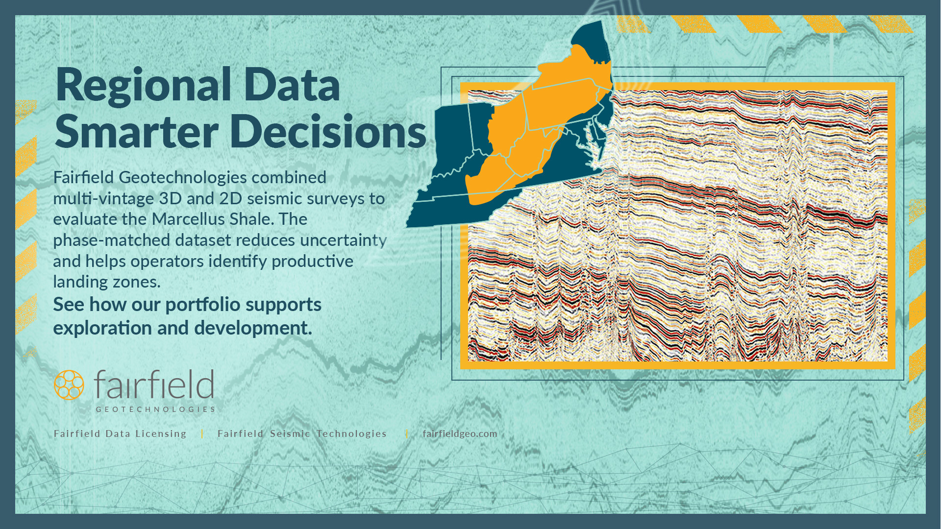
- • Fairfield Geotechnologies conducted a regional evaluation of the Marcellus Shale, integrating 3D/2D seismic surveys with production analytics to bring clarity to a geologically complex basin.
- • By harmonizing seismic data across thousands of square miles, Fairfield identified structural trends, faulting, and optimal landing zones tied directly to production outcomes.
- • Analysis confirmed the Lower Marcellus over the Onondaga Limestone as the prime target, correlating seismic signatures with higher productivity and modern completions.
- • The study underscores how integrated seismic and production insights enable more precise drilling, improved well performance, and smarter field development in mature acreage.
Over the last decade, the Marcellus Shale has emerged as one of North America’s most prolific gas-producing formations. Spanning over 44,000 square miles across six states, this Middle Devonian shale reservoir is vast and variable. Its regional complexity presents both challenges and opportunities for operators committed to unlocking precision, productivity, and predictability in their development strategies.
At Fairfield Geotechnologies, we believe that regional integration and technically rigorous interpretation are foundational to successful exploration and development. That belief guided our latest collaborative effort: a regional evaluation of the Marcellus Shale across the Appalachian Basin, integrating 2D and 3D seismic surveys with modern production analytics.
From Regional Complexity to Prospect Clarity
Nine 3D seismic surveys totaling 3,406 square miles and 27 2D lines spanning over 1,500 linear miles were integrated into a consistent dataset.
These surveys were meticulously bulk-shifted and phase-matched, anchored to the Groundhog 3D survey as a regional reference. This harmonized view enabled a basin-wide interpretation of the Marcellus and underlying Onondaga formations, which has been essential for understanding structural trends, fault systems, and reservoir thickness.
The result was a consistent seismic signature across one of the most geologically mature and operationally complex basins in North America.
Why Our Appalachian 3D Matters
Spanning key parts of Westmoreland, Indiana, and Armstrong Counties in Pennsylvania, our Appalachian 3D dataset offers an integrated regional perspective.
As a prime example, the Groundhog 3D area has seen 142 horizontal Marcellus Shale gas wells drilled since 2009. These wells serve as a valuable calibration set, helping to tie seismic character directly to production behavior. This correlation has enhanced our understanding of faulting, fracture networks, and reservoir continuity — insights that extend across the broader dataset.
We examined first-12-month normalized gas production per lateral foot across the dataset. The results were clear:
- • Top 5 wells: Averaged 317 Mcf/ft, completed 2021–2022, with 3-mile laterals and modern frac designs.
- • Bottom 5 wells: Averaged 156 Mcf/ft, completed 2011–2012, with shorter laterals and early-stage completions.
The critical differentiator? Landing zone selection enabled by improved seismic control and enhanced stratigraphic insight.
The Target: Lower Marcellus Over Onondaga
By tying production data to seismic inversions and wireline logs, we pinpointed the Lower Marcellus, directly above the Onondaga Limestone, as the optimal target zone. This interval:
- • Exhibits high acoustic impedance contrast, making it seismically resolvable.
- • Correlates with high TOC (total organic content) and thicker pay zones.
- • Aligns with the top-performing laterals across the basin.
With modern tools and integrated interpretation, operators are no longer drilling unknowingly. They’re landing precisely, guided by insights not only from local data, but also from lessons learned across basins.
The Bigger Picture: From Data to Decisions
Our goal at Fairfield is to transform uncertainty into insight and data into action. This study illustrates how multi-vintage seismic integration, when paired with production analytics, can drive smarter field development, longer laterals, and ultimately, higher EURs.
As the basin continues to mature, the next frontier isn’t just discovering new acreage. It’s optimizing what we already know, using smarter subsurface science to unlock remaining value.
Looking Ahead
Fairfield Geotechnologies is proud to partner with clients across the Appalachian Basin and beyond to bring geophysical clarity to complex plays. Whether you’re repositioning in mature acreage, planning infill development, or exploring the CCS potential of legacy assets, our team is ready to support you with tailored geoscience solutions and strategic insight.
If you’re navigating the Appalachian, let’s talk. We’re happy to share a shapefile of our seismic coverage so you can evaluate alignment with your acreage or areas of interest.
The answers are in the data — we’ll help you see them.
Note: The marketing of select Appalachian datasets is conducted in cooperation with Geophysical Pursuit, Inc. (GPI)
Post Date
Oct 02, 2025Post Category
Industry Articles
Case Studies