Fairfield Launches Phase II of Sand Dunes 3D Survey, Expanding Delaware Basin Coverage
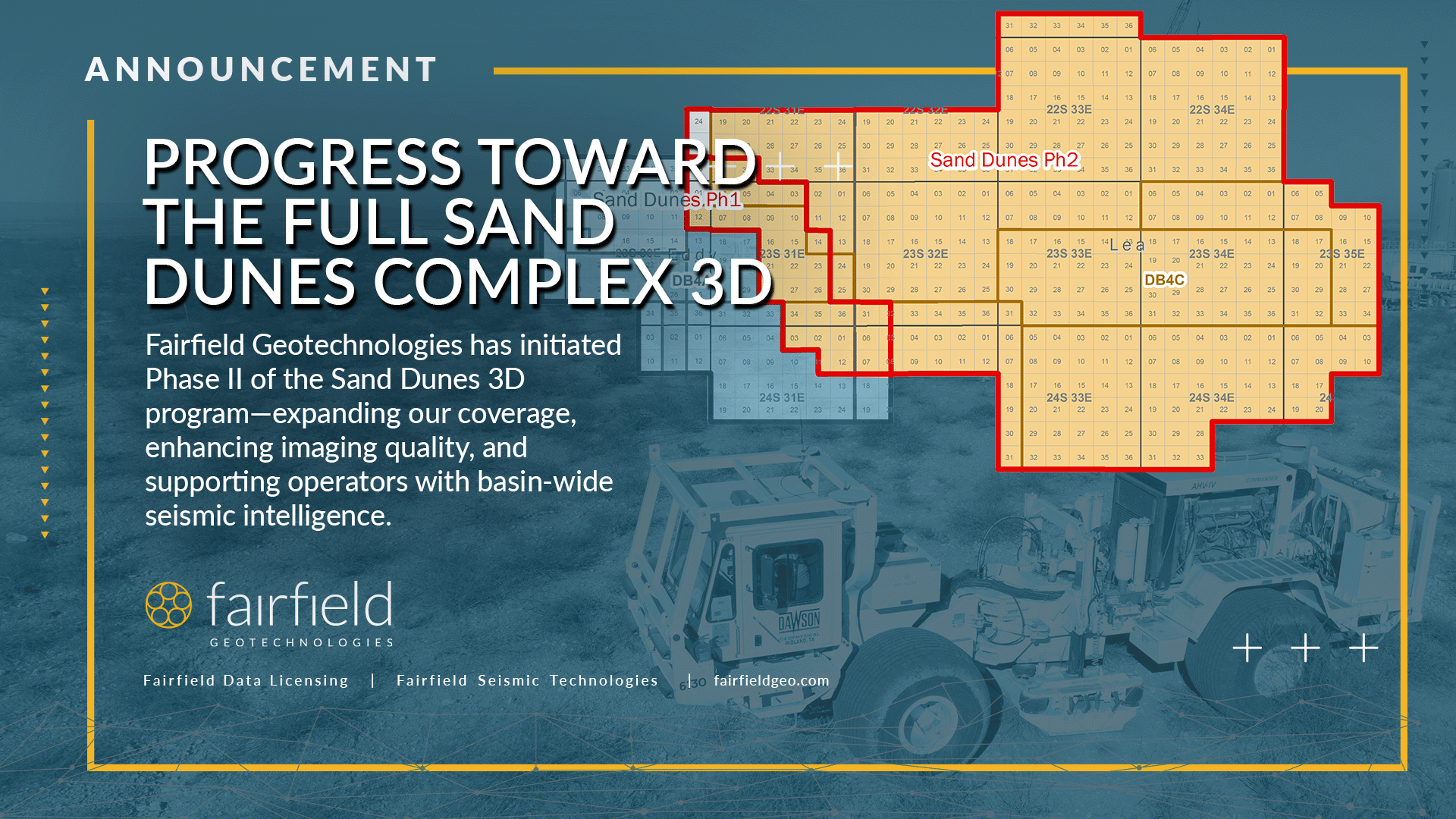
[HOUSTON, Dec. 17, 2025] – Fairfield Geotechnologies, a leader in high-resolution multi-client seismic solutions, announces the launch of Phase II acquisition for the Sand Dunes 3D seismic program in the Delaware Basin. This phase will add 371 square miles of high-density coverage across New Mexico’s Eddy and Lea Counties, expanding the project’s total output area to 449 square miles.
Phase I of the program, completed in January 2025, covered 113 square miles and laid a continued foundation for our basin-scale imaging efforts. Together, the two phases represent a major step in Fairfield’s ongoing commitment to providing operators with the data quality and technical insight required in one of North America’s most prolific and complex hydrocarbon provinces.
Once both surveys are fully integrated, the result will be the Sand Dunes Complex 3D, a large-scale, high-resolution seismic dataset purpose-built to support reservoir development across the northern Delaware Basin.
“Fairfield Geotechnologies continues to push the boundaries of seismic technology to support our clients’ success,” President and CEO Joe Dryer says. “The completion of the Sand Dunes 3D survey is a testament to our team’s dedication, innovation, and ability to deliver transformative solutions. This project represents another significant step forward in helping unlock the full potential of the Delaware Basin.”
With one of the most expansive multi-client seismic data libraries across the Permian, Appalachian, and Niobrara Denver-Julesburg Basins, Fairfield Geotechnologies remains committed to delivering clarity with confidence in every major U.S. hydrocarbon region.
To explore the Sand Dunes Complex 3D on our interactive map, visit https://fairfieldgeo.com/map/all.
About Fairfield Geotechnologies:
Fairfield Geotechnologies is a leading provider of high-resolution multi-client seismic data and services in the United States. By combining market-leading subsurface reflectivity and signal imaging techniques with strategic partnerships, Fairfield Geotechnologies delivers a superior solution for developmental exploitation.
For more information, please contact:
Frank Brown, Vice President, North American Land
281-275-7788
Post Date
Dec 16, 2025Post Category
New Products